
Walk an Ewa Gentry Street
A reliable Ewa Gentry street directory starts with land, not a guessed name. Honolulu's official systems use the situs address, meaning the place where the parcel sits, and the Tax Map Key, or TMK. Ownership shown by the assessor is public assessment data. It is not proof that the owner lives there. Hawaiʻi also offers no public voter-roll browse by street, so current household claims need restraint. The sound approach is to build a record trail, label what each record proves, and leave unknown occupants unknown.
- Normalize the full street line with USPS, while keeping the original spelling and unit.
- Use the Honolulu parcel selector or HoLIS to obtain the TMK and confirm the parcel shape.
- Open RPAD/QPublic and record the situs, mailing address, assessed owner, tax year, and retrieval date.
- Search DPP by TMK for permit history, then use the current owner and legal description in the Bureau of Conveyances.
- For older occupants, ask a library for address-indexed telephone or criss-cross holdings and compare dated editions.
This sequence separates three ideas that are often blurred: a postal address, a mapped parcel, and a household. It also lets a street-by-street search survive a spelling change because the TMK and legal description can carry the trail forward.
Ewa Gentry TMK Bridge
The Honolulu regulatory parcel selector accepts an address label, address ID, point of interest, current tax parcel, regulatory parcel, or TMK. That choice matters in Ewa Gentry. A roadway or common-area polygon may sit beside a home but may not be an addressable lot. Condominium and association parcels may also carry suffixes or legal detail that a plain street search hides.
- Parcel
- A mapped unit of land used for tax or regulatory records.
- Situs address
- The physical location of the parcel, which may differ from its tax mailing address.
- Plat
- A recorded map that divides land into lots, blocks, roads, or other areas.
- Criss-cross directory
- A directory arranged by address or phone number instead of primarily by surname.
The selector is the best handoff from typed address to parcel key. Save both the formatted and numeric TMK when shown, since Honolulu systems do not always display the key in the same style.
The official parcel selector also shows the search surface used to make that handoff.
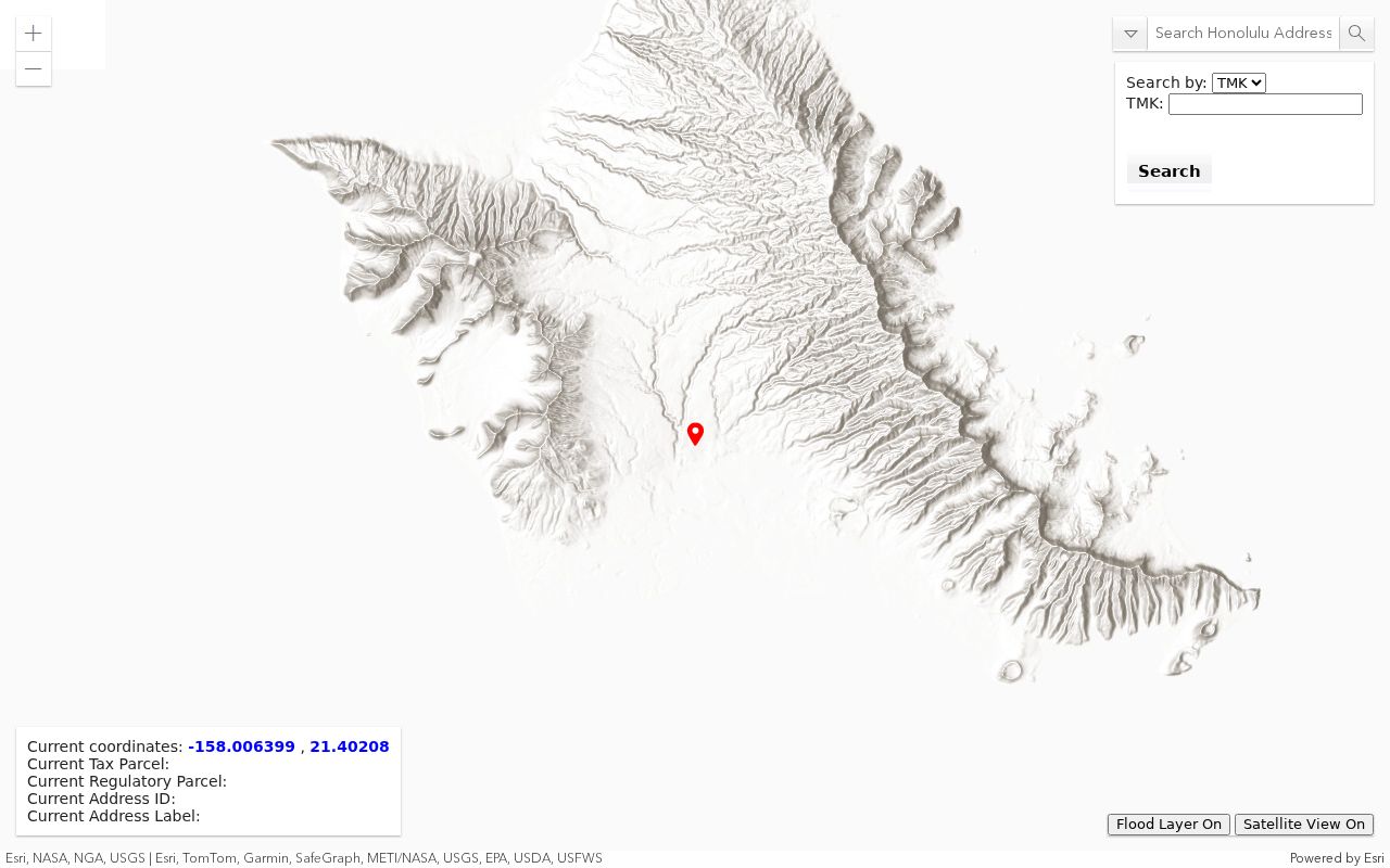
Its choices reinforce why a current tax parcel and a regulatory parcel should not be treated as the same object without checking.
Ewa Gentry Parcel Fields
The assessor and GIS records expose different parts of the address. RPAD/QPublic holds the assessment profile, while the state parcel layer supplies geometry and TMK fields. The live QPublic application's owner-name controls could not be fully verified because its endpoint blocked inspection, so the table below stays with fields supported by the official RPAD guidance.
| Field | Record It As | Street Use |
|---|---|---|
| Site address | Number, street, unit, locality | Finds the physical parcel |
| TMK / property ID | Both displayed formats | Links RPAD, HoLIS, DPP, and deed work |
| Mailing address | Separate from situs | A contact clue, not residence proof |
| Assessment history | Year and land/building values | Dates a tax record, not occupancy |
| Exemption | Type and effective year | Suggestive only because records may lag |
| Map and permit links | Label and source URL | Routes the parcel into other files |
RPAD warns that its profile is general tax information, not current legal documentation. Data changes periodically, and an exemption can reflect an earlier owner until a new claim is processed.
Ewa Gentry Address Records
No single Ewa Gentry street directory contains every address fact. Each custodian keeps a narrower record, and all documented access channels matter. Online profiles are quick, map viewers define the parcel, office staff retrieve older files, and a written UIPA request can reach a reasonably described public agency record that is not posted.
| Record Set | Keeper | What It Shows | Access |
|---|---|---|---|
| Property profile | Honolulu RPAD | Situs, assessed owner, mailing address, assessment | QPublic or RPAD office |
| Parcel geometry | HoLIS / State GIS | TMK, zoning, plat, area, nearby shapes | Viewer and REST layer |
| Deeds and liens | Bureau of Conveyances | Grantors, grantees, legal descriptions, instruments | Free index, paid images, room or written request |
| Permit files | Honolulu DPP / DAIB | Applications, approvals, reviews, work chronology | Online summary or older-file request |
| Historical directories | UH H&P, HSPLS, HSA | Dated address and household clues | Library, microform, archive, or preview |
A name in one row should not be silently promoted into another. A deed grantee owns an interest described by the instrument. A permit applicant filed for work. An assessor name belongs to the tax profile. None alone establishes everyone who lives at the site.
For records missing online, contact the office that created them. RPAD has Honolulu and Kapolei service locations. DPP's DAIB retrieves older permit files, while BOC maintains a public reference room in the Kalanimoku Building. A focused request should name the record type, TMK, street address, and date range. Hawaiʻi's Uniform Information Practices Act offers a request route for public agency records, but the Office of Information Practices gives guidance and handles appeals rather than storing every file. This fallback chain is part of a complete address search.
Map Ewa Gentry by Street
The Honolulu Land Information System is map-first. Zoom to a segment, click the target polygon, then inspect nearby shapes one by one. The state mirror includes parcel type, TMK variants, zone, section, plat, area measures, a street-parcel flag, and a QPublic link. Geometry defines land adjacency, not a social relationship.
The Oʻahu parcels and zoning layer exposes those machine-readable fields for checking the map.
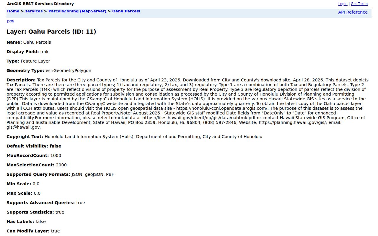
The layer can return parcels inside an Ewa-area envelope, but it returns parcel facts rather than a resident roster.
Recorded area, GIS acreage, and RPAD-stated area may differ. Preserve the label beside each value. Also exclude regulatory-only, road, and common-area polygons before treating a map result as a possible home.
Note: A touching polygon can be a road or common area, so map adjacency must be checked against parcel type and addressability.
Ewa Gentry Permit Trail
Honolulu DPP accepts a permit or application number or a TMK and can display Details, Approvals, Plan Reviews, and Staff Assignment. Those fields help date construction and alterations. They do not show who occupied the property. Older material requires a Request to View Records through the Data Access and Imaging Branch, using the TMK and exact street address.
The DPP permitting FAQ explains permit searches, old-file retrieval, and address-correction reasons.
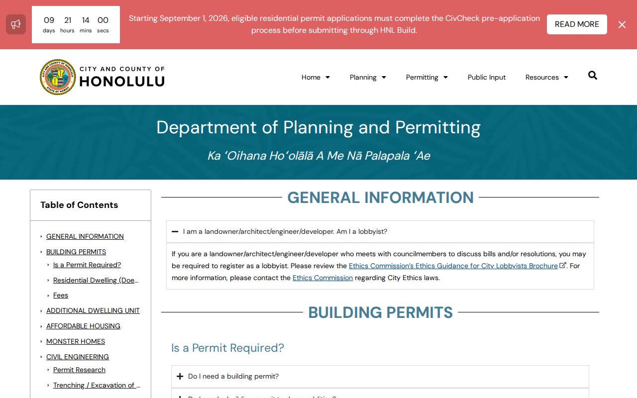
This official fallback is important when a modern permit portal has only a summary or no scanned historical plan.
DPP's address work also helps when a parcel is vacant, newly built, assigned an incorrect number, given an added dwelling, or checked for legal status. These are documented reasons for an address mismatch, not evidence of a community-wide renumbering.
Ewa Gentry Deeds by Address
The statewide Bureau of Conveyances research route turns a current parcel lead into a title trail. Search the assessed owner as a grantee, inspect the deed's legal description and prior-instrument reference, then compare its lot, block, tract, or TMK with the mapped parcel. BOC handles both the Regular System and Land Court, so the system label and recording number must travel with every note.
The current FAQ places post-1976 documents in the online path. Earlier or complex work goes through the public reference room or a written search request. Online searching is free, document images are purchased, and official copies cost $1 per page. Recording-number formats also changed across eras, which makes the date and original format essential.
A recent local safety reason supports this check: a 2025 Hawaiʻi Attorney General release concerned alleged forged deeds recorded through BOC. Verify an instrument in the official system before relying on an unsolicited copy or payment demand.
Ewa Gentry Address Geography
Ewa Gentry is a Census-designated place, not an incorporated city with its own assessor or recorder. USPS commonly uses Ewa Beach for the postal city, while Honolulu systems may label the same place by district, parcel, development plan, or neighborhood-board geography. A mailing label is therefore useful for delivery but weak as a land boundary.
Normalize the address with the USPS ZIP Code Lookup, then keep its result beside the Census and parcel labels. The current DPP map places Ewa Beach, Ewa, Ewa Marina, Iroquois Point, Fort Weaver Road, and Ewa Beach Road in the same broader planning area. No official Ewa Gentry-wide renumbering year was found.
When old and new address forms conflict, use a TMK, deed legal description, permit file, or subdivision lot as the bridge. Never rewrite the locality printed in a historic source.
The Census identifies Ewa Gentry as its own CDP, while the Ewa Neighborhood Board covers a wider civic area and Ewa by Gentry association materials cover a narrower community framework. Neither boundary is a substitute for the parcel polygon. The distinction prevents a nearby postal or civic label from being mistaken for proof that a house falls inside the CDP.
Older Ewa Gentry Street Clues
The historical address layer belongs to dated directories, telephone books, newspapers, and archives. UH's Hawaiʻi and Pacific holdings document broad Honolulu and island directory runs, but the research found no separate Ewa-specific criss-cross series with confirmed years. Ask UH H&P or HSPLS staff for reverse-directory holdings by exact year and street instead of assuming an online gap means no record exists.
A 1933 Polk-Husted volume illustrates name, work, address, household, rear-address, and widow notation, but it predates modern Ewa Gentry. Search Ewa, Ewa Beach, older subdivision names, and spelling variants. For a full account of publishers and shelf runs, use the Ewa Gentry city directory material.
Ewa Gentry Street Privacy
An Ewa Gentry street directory cannot reveal a complete household. No public source reviewed exposes renters, visitors, utility customers, delivery records, or all household members by address. DMV address data is protected by federal law. Hawaiʻi's public voter fields do not create a public street browse, and authorized voter-file requests are bound to permitted purposes.
Assessor mailing and situs fields need special care. A tax mailing address can be outside Ewa Gentry. Trusts, estates, joint owners, and update delays can also separate the displayed owner from the person at the door. Address Confidentiality Program records and protected voter or court data must remain protected.
Lawful use. Use Ewa Gentry address records for lawful personal research. Never use them to stalk, harass, intimidate, or harm anyone.
The best final label is often narrow: “assessed owner as retrieved,” “permit applicant,” or “historical directory entry.” That phrasing preserves what the source truly says.